Altimetric Profile and Road Types
Display real-time altimetric profiles. Identify various road types (paths, trails, roads, etc.) to tailor your route according to your preferences and abilities.
Road Types and Altimetric Profile: Essential Elements.
OpenRunner redefines the route planning experience with its Explorer offer, providing advanced customization and crucial information after each route modification. Discover how the Explorer offer becomes your best ally, materializing altitudes and road types in clear graphics, essential for planning activities like hiking, gravel riding, mountain biking, or road cycling.
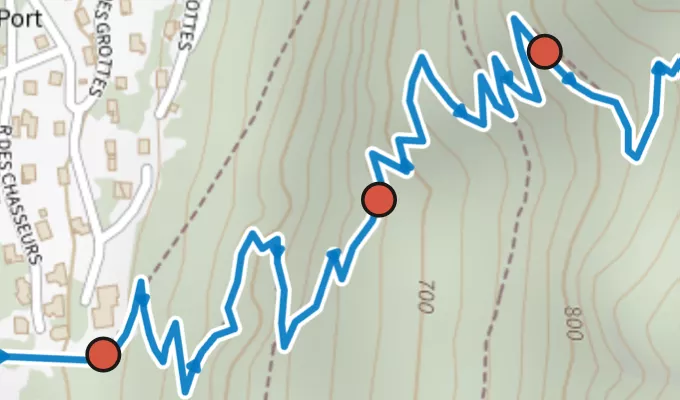
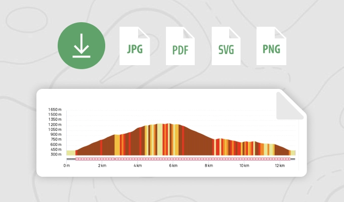
The altimetric profile becomes an essential tool with the Explorer offer. With each route modification, instantly access the altimetric graph, revealing upcoming ascents and descents. Whether seeking steep slopes for training or moderate altitudes for a relaxed ride, this graph becomes your visual guide for optimal preparation.
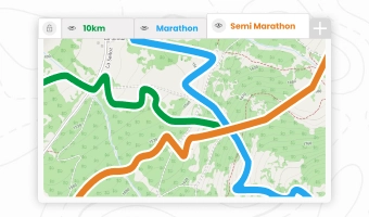
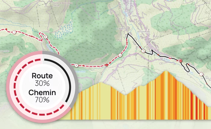
Road types are as crucial as the altimetric profile for a successful outdoor outing. Explorer offers a detailed view of the roads taken, distinguishing between 'paved and tarmacked surfaces', 'cycle paths and greenways', 'forest, agricultural, and forest fire access roads', and 'paths and trails'. This information is crucial for creating routes tailored to your preferences and the day's activity.
Whether you're a hiking enthusiast, gravel rider, mountain biker, or road cyclist, the Explorer offer on OpenRunner is your ultimate partner. Customize your routes based on specific activity characteristics. Whether seeking forest trails for mountain biking or paved roads for road cycling, the Explorer Pack ensures planning tailored to your needs.
The quality of your outing largely depends on the road types taken. The Explorer offer ensures precise planning, avoiding unpleasant surprises during your activity. Be assured of the quality of roads and trails for an optimal experience with every pedal stroke.
In summary, the Explorer offer on OpenRunner goes beyond simple route planning. It becomes your visual guide with altimetric graphics and road information after each modification. Whether you're a hiking enthusiast or an experienced cyclist, maximize your adventures with OpenRunner. Start today for personalized and high-quality outings!
This feature is part of the
Learn more
EXPL  RER
RER
Have questions about using this feature? Find all the useful information on our
help centre
.