
Distance
59.42 Km
Ascent +
601 m
Descent -
601 m
Est. duration
2h44
A word from the author
  Départ : Oberhausbergen - parking du cimetière - rue Adèle Woytt

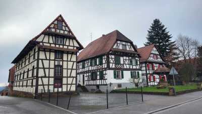
Circuit , vers le nord ouest par une très belle piste cyclable , vers Schnersheim   arrêt à voir l'église fortifié  ,  Willgotheim  commune se trouve dans le Kochersberg, région historique et culturelle , Hohfrankenheim  , Berstett et Dingsheim
Route photos

User reviews
This route does not have any reviews yet. Have you done it? Be the first to write a review!
Weather

Feature available with the EXPLORER subscription
Summary
Discover this 59.4 km bike route near Oberhausbergen. It has a cumulative ascent of more than 600m. Allow about 2 hours and 44 minutes to complete this route.
Route creation date: December 4, 2021 at 13:36:01.
Last update of the route sheet: December 1, 2025 at 13:35:03.
Route ID: 14002083

