Distance
22.94 Km
Ascent +
688 m
Descent -
1,273 m
Est. duration
8h09
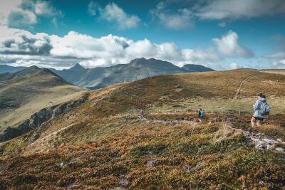
A word from the author
Seconde partie d'un week-end de 2 jours à travers une partie du volcan Cantalien, sans voiture. Depuis le Lioran, montée au Plomb du Cantal puis chemin de crêtes jusqu'à Vic-sur-Cère où l'on retrouve la gare et le train du retour. Parcours à retrouver sur www.lesterresdumilieu.fr - Photos : P. Villemejane - Les Terres du Milieu - Tous droits réservés
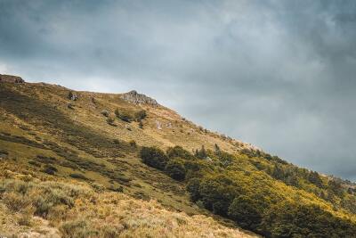
Route photos


User reviews
This route does not have any reviews yet. Have you done it? Be the first to write a review!
Passes along the route
5 Km
Pas des Alpins
1,750 m7 Km
Col de la Pourtoune
1,693 m9 Km
Col de Chèvre
1,618 m20 Km
Col de Curebourse
994 mPasses extracted from the Club des Cent Cols catalogue
Summary
Discover this 22.9 km hiking route that starts in Laveissière and ends in Vic-sur-Cère. This route includes 8.6 km of paths and 8.1 km of forest tracks. It has a cumulative ascent of more than 680m. Allow about 8 hours and 9 minutes to complete this route.
Route creation date: April 2, 2024, 20:07:48.
Last update of the route sheet: January 26, 2025, 10:05:02.
Route ID: 18664168