Distance
13.66 Km
Ascent +
954 m
Descent -
758 m
Est. duration
6h24
A word from the author
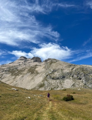
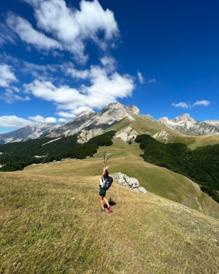
Parcours très beau depuis la gare de Lus en passant par le centre du village avant d'aller explorer les crêtes et la Pointe Feuillette
5
50 nuances de trek
Route photos
User reviews
This route does not have any reviews yet. Have you done it? Be the first to write a review!
Passes along the route
7 Km
Col de Chausseyras
1,571 m8 Km
Col de Paille
1,845 m10 Km
Col Lachaud
1,622 m12 Km
Col de la Croix
1,497 mPasses extracted from the Club des Cent Cols catalogue
Summary
Discover this 13.7 km hiking route near Lus-la-Croix-Haute. This route includes 9.1 km of paths and 3.2 km of roads. It has a cumulative ascent of more than 950m. Allow about 6 hours and 24 minutes to complete this route.
Route creation date: May 23, 2025, 10:57:19.
Last update of the route sheet: May 27, 2025, 11:58:50.
Route ID: 21457618