Distance
14.17 Km
Ascent +
465 m
Descent -
449 m
Est. duration
4h46
A word from the author
Pour les plus courageux préférez le circuit dans le sens horaire.
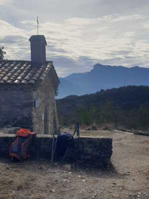
Route photos
User reviews
This route does not have any reviews yet. Have you done it? Be the first to write a review!
Passes along the route
8 Km
Col de la Tuilerie
576 m10 Km
Col de Pourcheton
610 mPasses extracted from the Club des Cent Cols catalogue
Summary
Descubre este recorrido de senderismo de 14,2 km cerca de Saillans. Presenta un desnivel acumulado de más de 460m. Calcula unas 4 horas y 46 minutos para completar esta ruta.
Route creation date: February 10, 2026, 08:50:37.
Last update of the route sheet: February 10, 2026, 08:47:35.
Route ID: 23340658