Distance
34.29 Km
Ascent +
794 m
Descent -
205 m
Est. duration
1h57
A word from the author
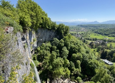
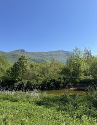
Parcours pour se rendre à la rive étoilée par le marais de Lavours, la cascade de Cerveyrieu et les gorges de thurignin. Attention, cet aller retour s'effectue partiellement sur un chemin blanc. à éviter selon vos pneus.
50 nuances de trek
Route photos
User reviews
This route does not have any reviews yet. Have you done it? Be the first to write a review!
Summary
Discover this 34.3 km bike route that starts in Culoz-Béon and ends in Plateau d'Hauteville. This route includes 33 km of roads. It has a cumulative ascent of more than 790m. Allow about 1 hour and 57 minutes to complete this route.
Route creation date: April 26, 2026, 19:00:02.
Last update of the route sheet: April 26, 2026, 19:01:00.
Route ID: 23906534