
Distance
69.92 Km
Ascent +
3,604 m
Descent -
3,642 m
Est. duration
13h58
A word from the author
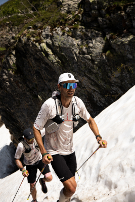
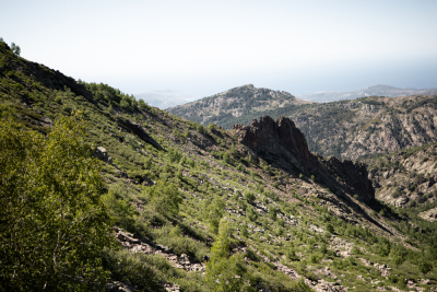
  Quelle journée ! Nous sommes enfin dans la partie sud du GR. Après les premiers mètres de bitume, la journée aura été riche en paysages et sentiers variés. Du lac de Ninu et ses plaines roulantes, aux crêtes de l’Onda, en passant par le panorama du Capitellu… what a day 🤩

Plus qu’une étape, mais demain c’est recup 🏖️

//

What a day! We are finally in the southern part of the GR. After the first few meters of asphalt, the day was packed with diverse landscapes and trails. From Lake Ninu and its smooth, rolling plains, to the Onda ridges, and the panoramic views from Capitellu… what a day 🤩

Only one stage left, but tomorrow is recovery day 🏖️
Route photos
User reviews
This route does not have any reviews yet. Have you done it? Be the first to write a review!
Passes along the route
11 Km
Bocca â Reta
1,883 m
17 Km
Bocca d'Acqua Ciarnente
1,568 m
21 Km
Bocca alle Porte
2,225 m
23 Km
Bocca a Soglia
2,015 m
24 Km
Col de Rinoso
2,155 m
25 Km
Col de la Haute Route
2,206 m
28 Km
Bocca Manganello
1,800 m
30 Km
Bocca a Meta
1,885 m
33 Km
Bocca d'Oreccia
1,427 m
49 Km
Bocca Palmente
1,645 m
68 Km
Col de la Flasca
1,430 m
70 Km
Col de Verde
1,289 m
Passes extracted from the Club des Cent Cols catalogue
Weather

Feature available with the EXPLORER subscription
Summary
Discover this 69.9 km trail route that starts in Albertacce and ends in Palneca. This route includes 59.7 km of paths and 2.5 km of forest tracks. It has a cumulative ascent of more than 3600m. Allow about 13 hours and 58 minutes to complete this route.
Route creation date: June 17, 2026, 15:26:55.
Last update of the route sheet: June 25, 2026, 15:17:06.
Route ID: 24390820

